As a winter storm and cold sweep the US, hundreds of flights are canceled
Before the busiest travel days of the year, a strong Arctic winter storm is moving into the US and parts of Canada, bringing bitter-cold temperatures and flight delays.
Winter weather alerts affect more than 100 million people throughout the US, and this weekend’s snowfall is predict to cause travel disruption.
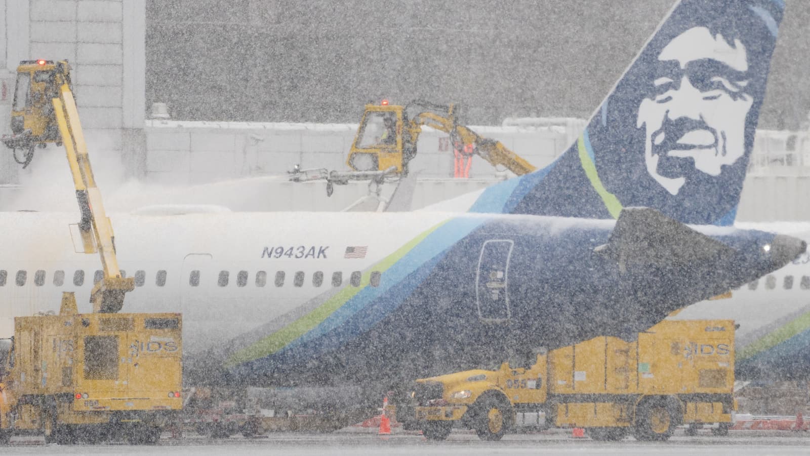
Major airports have already cancelled flights as a result of the storm.
According to experts, the cold spell might bring the coldest Christmas decades.
The National Weather Service predicts that by the end of this week, certain areas of the nation may see bone-chilling lows of -50F (-45C) to -70F. (NWS).
The winter storm may become a “bomb cyclone” by Friday, which is a colloquial term for a particular kind of severe storm that is rapidly strengthening.
El Paso, Texas, will experience temperatures as low as 15F as the Arctic air mass is predict to dip as low as the US-Mexico border (-9.4C).
Even Florida, known as the Sunshine State, is predict to see its coldest Christmas in thirty years.
The NWS has described the storm as a “once-in-a-generation” winter weather event as it moves toward the Great Lakes region, where its pressure is predicted to reach the equivalent of a Category 3 hurricane.
In addition to precipitation and strong gusts, the storm is anticipate to bring damage and power outages to the Midwest and Canada.
Where have the storm and brutal cold struck?
As the storm and harsh weather march eastward, millions of people are already experiencing freezing temperatures:
- Several US states, including Texas, Kansas, and Missouri, have experienced record-low temperatures.
- Temperatures in Colorado dropped from 42F on Thursday to a record-breaking low of -9F. In the meantime, Wyoming has experienced a -35F dip in temperature.
- Forecasters anticipate that Chicago will experience heavy snowfall later on Thursday, accompanied by wind gusts of up to 50 mph (80 km/h).
- Canada’s National Weather Service warned that a significant winter storm with “strong and potentially catastrophic winds” is anticipated to hit much of Ontario and parts of Quebec on Thursday and persist through the Christmas holiday.
The winter storm has disrupted traffic.
The storm hit on one of the year’s busiest travel days. The Transportation Security Administration predict that the volume of Christmas travel would be nearly at pre-pandemic levels, with Thursday expected to be the busiest day.
FlightAware’s flight-tracking website reports that over 2,200 flights have already been cancel on Thursday and Friday in the US.
This includes cancellations from the nation’s busiest airport, Chicago.
Major airlines like United, Delta, and American have offered to waive fees for passengers who desire to rearrange their flights in anticipation of travel difficulties.
This weekend’s vehicle traffic is also predict to be severely hamper by snowy conditions and icy roads.
On Wednesday, the visibility was so low that it forced the closure of several roads along the Wyoming-Colorado border.
Between Friday and January 2, more than 112 million individuals, most of whom will travel by car (102 million), are expect to travel more than 50 miles (80 km) from their homes.
According to US Transportation Secretary Pete Buttigieg, the Thanksgiving holiday was mostly uneventful.
Unfortunately, that won’t be the case when Christmas approaches.
States of emergency declared
The governors of Kentucky, North Carolina, Georgia, and Oklahoma declared a state of emergency.
Some states, including Maryland, began emergency response activities in advance of the storm, and others provided warming shelters.
The Denver Coliseum, an indoor arena in Colorado, has been transform into a warming center.
US President Joe Biden stated on Thursday that his administration has spoken with the governors of the 26 affected states and is ready to assist as required.
As the situation got worse, he also urge people to stay home. Mr. Biden urged people to take the storm “very seriously.”
What is a bomb cyclone?
As this storm forms over the Great Lakes region, the name “bomb cyclone” has been use to characterize it. But what is that specifically?
A storm is refer to as a bomb cyclone when it strengthens quickly, and its central air pressure drops by at least 24 millibars in 24 hours.
They are also known as bomb cyclones because of the explosive force that the abrupt pressure drop causes.
Storms of this nature can produce a wide range of weather, such as blizzards, intense thunderstorms, and heavy precipitation.
Because of the region’s frigid topography and warm Gulf Stream current, bomb cyclones most regularly strike the east coastlines of the US and Canada.